
CENG
160/260
GIS
in Water Resources
|
CENG
160/260
|
|||
|
GIS
in Water Resources
|
Instructor: 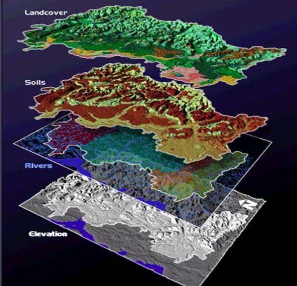
Class Meeting Time and Office Hours:
T Th, 2:00-3:40 pm, EC608A
Office Hours: Mon, Thurs 4:00-5:30 pm. Email me to set up other office hours by appointment.
Texts and other materials (texts are optional; memory stick is required):
Getting to Know ArcGIS Desktop (updated for ArcGIS 10), T. Ormsby, E. Napoleon, R. Burke, L.Feaster, and C. Groessl, 2010. Also available from ESRI Press.
Arc Hydro: GIS for Water Resources, D.R. Maidment, editor, ESRI Press, 2002, ISBN 1-58948-034-1. Available from the bookstore, or directly from the ESRI site (same price a both locations)
8GB or larger USB memory stick (available at SCU bookstore or places like Frys). The exercises will use some large datasets that will exceed your allocated space on the network. A memory stick will allow you to save class materials and back them up on another machine.
One copy of each of the texts, as well as other ArcGIS references, are in the CE Computer Lab. The campus library will also have them available for reference.
Course Description:
Introduction to Geographic Information System (GIS) technology with applications in watershed analysis and hydrology. Obtaining and processing digital information for watersheds, mapping terrain, spatial analysis, computing river networks from digital elevation models, preparing data for hydrologic modeling of water supply and flood studies.
Course Goals:
Skills to be developed include obtaining, processing, and displaying digital information for watersheds, producing river networks from digital elevation models, mapping the spatial variability of precipitation, and preparing input data for hydrology models. Students will pursue a class project of their own design. ESRI ArcGIS software will be used for all exercises. Linux-based freeware for GIS and mapmaking may be briefly introduced as time permits and class interest demands, and connecting Google Earth to ESRI ArcGIS will also be covered.
Prerequisites
Junior or Senior standing. No previous experience with GIS is expected. Basic computer skills (including Microsoft Windows operating system, Excel, Word, Windows Explorer for creating and managing directories) is essential. An understanding of the hydrologic cycle and an interest in watersheds is important. Additionally, a familiarity with maps and map reading (especially topo maps) is desirable.
Assessment and other class policies:
This class places a heavy emphasis on class projects, homeworks and assignments. The grading structure for this class reflects this (though it may be adjusted during the first half of the course):
| Homeworks and class participation | 10% |
| Class Exercises | 60% |
| Final Project | 30% |